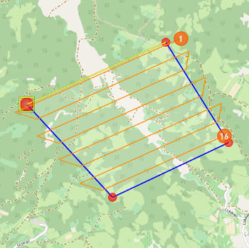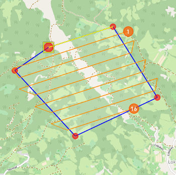
Use AREA PTS mode to draw area with automatically calculated waypoints. Area drawing mode is used in mapping missions where the UAV should go back and forth over an area to collect data.
 Draw area |
IMPORTANT: When the flight route is drawn with the individual waypoints the UAV follows the route repeatedly, returning to the first waypoint after the last visited waypoint. This is not the case for area or street area where the UAV flies to the Home position after the last visited waypoint of the mapped area. |
Click on the map to add the area points.
 Area points added to the map. |
BLUE lines represent area lines. ORANGE lines represent flight lines and define the path that the UAV will follow while flying above the area. Grid of flight lines is recalculated each time the new area point is added to the map (minimum three points must be added). ORANGE CIRCLE with a number inside represents a waypoint. There is a waypoint on each end of a flight line. The first and the last one in the sequence are marked with orange circles. |
Click on the area point to select it.
NOTE: When you have completed your route exit current drawing mode by deselecting it from Draw menu.
Parameters
Waypoints parameters are configured through the Mission Settings dialog. These values are applied when adding new waypoints to the map.
WARNING: In order to change the parameters of an area that is already added to the map you must first select the area line and then open Mission Settings dialog. Waypoints that are automatically calculated when drawing area or street area cannot be modified individually but only as a group through Mission Settings dialog (you can open Waypoint dialog but you cannot change the values).

