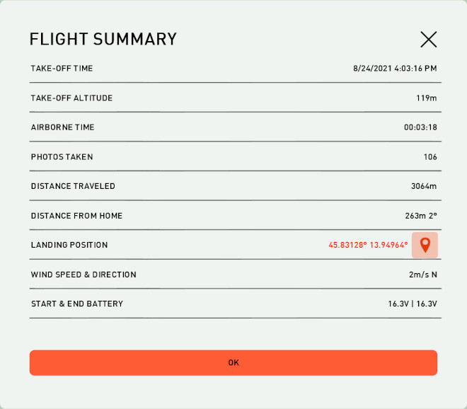
Flight summary dialog is accessible through the context menu. Its values are updated during the flight and preserved after the flight has completed.
IMPORTANT: If connection is lost, flight summary will show the last known location of UAV. If C3P is restarted, the previous data will be shown until UAV is connected.
 Sets wind speed and heading during the flight simulation. |
Parameter |
Value |
|---|---|
Take-Off time |
Time of Takeoff |
Take-Off altitude |
Altitude where the UAV was launched |
Airborne time |
The time that the UAV was flying. |
Photos taken Only for ppX UAS |
Number of photos taken during the flight. |
Distance traveled |
Distance represents the actual distance traveled from UAV's launching position to the current point in time. NOTE: Traveled distance will not be updated during the loss of communication and the restart of the program. Information about the traveled distance is lost during this period of time. Once the communication is established the previous distance will be updated with the new available data but it will not be accurate anymore. |
Distance from home |
Distance and azimuth from Home towards the UAV. |
Landing position |
Location of the UAV after landing displayed in Google Earth (values are being updated during the flight). |
Wind speed and direction |
Max wind during the flight and the wind direction. |
Start and End battery |
Battery Voltage at the beginning and at the end of the flight. |
Flight summary data
